Bringing urban land-change simulation to the next level (SILAR)
Anna Hersperger, Silvia Tobias, Daniels Saakjans, Somaie Abolhasani, Rafael Ramirez Eudave
2022 - 2025
Kooperation FinanzierungScrutinizing, standardizing and implementing land-use regulations on urban form and function (SILAR) 
Project Introduction 
It is widely accepted that spatial planning is the key policy activity aimed at managing the morphology and use of the built environment. Spatial planning systems are commonly multi-level, with local land-use planning often responsible for translating strategic goals set by regional and national authorities into a binding code that regulates Urban Form (physical components of urban environments such as buildings, roads and open spaces) and Function (activities and functions of urban environments commonly regulated via zoning). The tools used to set the code vary widely across Europe, however, their diversity and character are surprisingly underresearched and, therefore, poorly understood.
This lack of understanding hinders the progress of the ongoing digitalisation of planning – a prominent trend among European planning systems. The digitalisation trend shows the general efforts of countries to simplify planning processes, improve outcome quality, strengthen decision-making reasoning, improve enforcement efficiency and increase process transparency via the use of digital technologies and geospatial data. However, the absence of systematic standardisation of land-use tools prevents the further integration of planning into spatial simulations – an essential component of planning digitalisation.
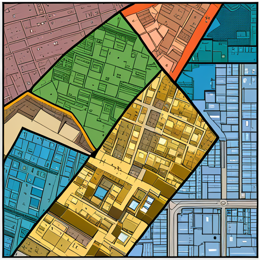
The increasing availability of digital plan data in the form of downloadable vector data provides promising opportunities for implementing detailed Form and Function regulations in urban land-change simulations. The digitalisation and integration of digital plan data offer new opportunities to overcome the drawbacks of using traditional 2-D land-use plans to regulate the three-dimensional built environment. As theories on European land-use planning are lacking, the necessary basis for a targeted advancement of practice is missing.
Project aims and outcomes 
With the SILAR project, we aim to conceptualise land-use regulations in 32 European countries in times of digital transformation and, based on this, develop tools for integrating land-use specifications from digital plans into urban land-use simulations. Specifically, we address the following main questions:
Question 1: What are the current concepts and tools for regulating form and function in European municipal land-use plans and how can this practice be further developed in the context of digitalisation of planning?
Question 2: How can we combine state-of-the-art simulation approaches and standardised digital land-use plan data to simulate urban morphology and land-use mix in 2-D and 3-D in land-change scenarios for city regions, i.e. larger scales?
A survey will provide a theoretical overview of land-use planning in European countries, while case studies will allow the development of a theory-based framework of regulatory approaches and regulations for Form and Functions which will serve as the basis for standardisation tools. The integration of standardised land-use regulations into urban simulations will be tested for selected urban regions in a multi-scenario analysis. Plausible 3-D morphological configurations and mixed land uses will be modelled and visualised on a regional scale to assess the feasibility of the approach for planning support.
Based on the qualitative and modelling results, theory-based options to address digitalisation, standardisation and convergence tendencies within land-use planning will be drafted and discussed.