Thermomechanical modelling of rock-ice avalanches for large scale hazard indication mapping in Uttarakhand Province, India
Perry Bartelt
ProjektmitarbeitendePerry Bartelt
Yves Bühler
Andrea Manconi
Jessica Munch
2021 - 2023
Kooperation FinanzierungIn this project, funded by the Swiss Agency for Development Cooperation (SDC / DEZA), we propose to apply large scale hazard indication mapping algorithms to the Himalayan province of Uttarakhand. Our goal is to identify unstable rock/ice masses and perform thermo-mechanical simulations - at the large-scale - to predict the danger of rock/ice avalanches, such as the recent event in Chamoli. This research is strongly motivated by recent rock/ice avalanche events, such as the rock avalanche and debris flow that occurred at Piz Cengalo, Switzerland, in 2017, the ice avalanche destroying the base camp at Mount Everest and the Aru-Co glacier collapse in Tibet where extensive modelling work has been performed by the project staff.

Rock-ice avalanches are events where a glacier and potentially part of the underlying bedrock break and form a gravitational flow. These phenomena are particularly tricky to understand as they involve rocks, ice, snow and water which makes it a very complex physical system. Several of these events happened over the past years, such as in Langtang, Nepal, in 2015 after the 7.8 magnitude Gorkha earthquake (Gnyawali et al., 2017) which mobilized 14.38 × 10⁶ m3 of rock and ice and accumulated 6.95 × 10⁶ m3 debris in the valley floor (Lacroix, 2017), or in Piz Cengalo area, Switzerland, in 2017, where 3×10⁶ m3 of rocks fell off the mountain and entrained 6×10⁵m3 of ice from the glacier (Mergili et al., 2020). More recently in Uttarakhand Province, in Chamoli, India, in February 2021, about 27× 106 m3 of rock and ice collapsed from Ronti Peak (Shugar et al., 2021). The resulting mass flow damaged infrastructure and ~200 people went missing. All of these events hence have disastrous consequences for people and infrastructures, not only because of the falling rocks and ice, but also because of secondary processes such debris flows resulting from the melting water produced as the ice melts during the avalanche.
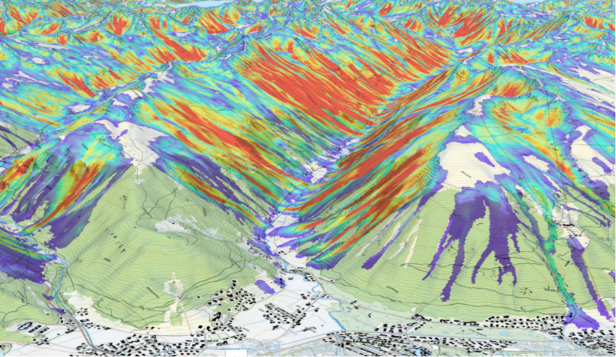
In order to better understand these phenomena and assess and set up large scale hazard maps in areas that are prone to rock-ice avalanches, scientists in Switzerland (CERC - SLF Davos) and India (Building Institute in Roorkee) are teaming up to gather field data, identify unstable rock/ice masses, and perform thermo-mechanical simulations – at the large-scale – to predict the danger of rock/ice avalanches, such as the recent event in Chamoli. The numerical modelling is performed using a software that has been developed by the research team at SLF, RAMMS (RApid Mass Movement Simulation), which is aimed at modelling gravitational mass movements and is made of several modules to model snow avalanches, rockfall and more recently, rock-ice avalanches.
Some preliminary studies have already been done using RAMMS on previous events such as the rock-ice avalanche which occurred at Piz Cengalo in 2017 (Figure 1.). The numerical models give insights on the areas that are potentially exposed to rock/ice damage, but also to the subsequent debris flow.

Collaboration 
Funding 
Federal Department for Foreign Affairs - Swiss Agency for Development and Cooperation SDC
