
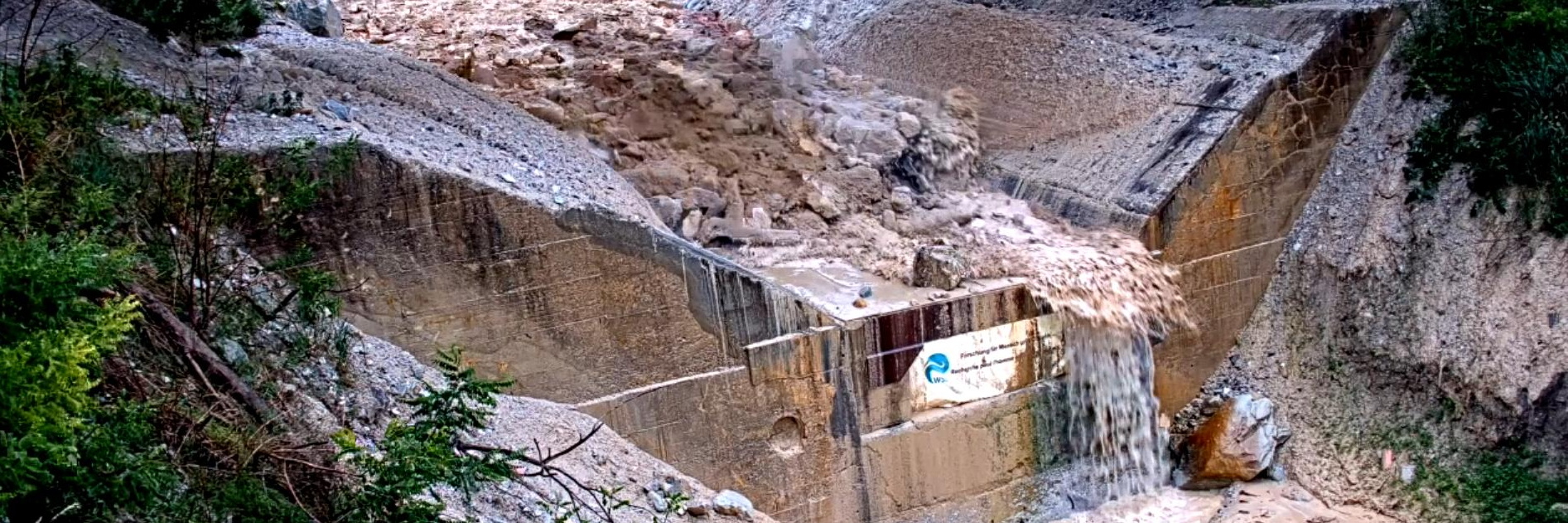
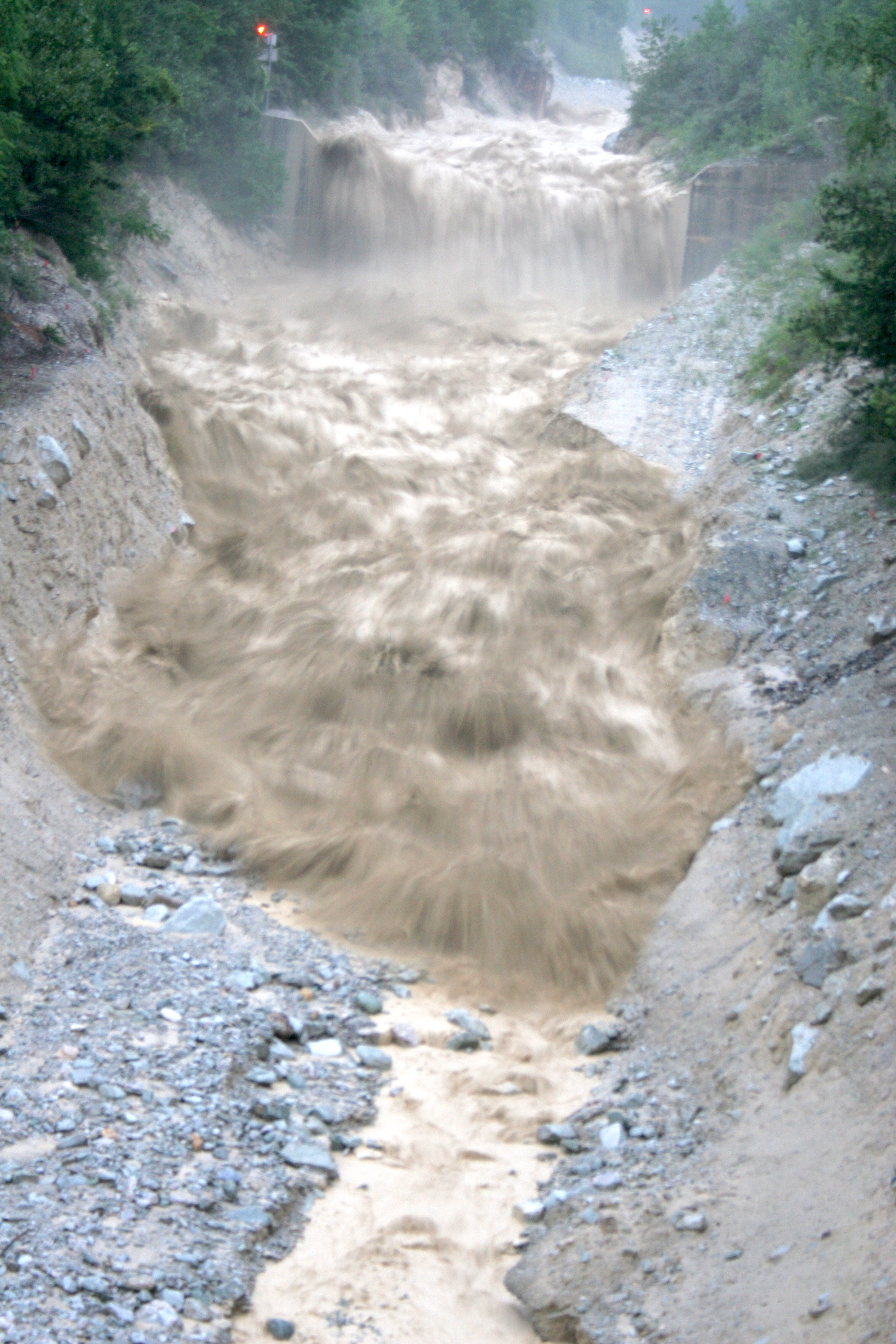
Since 2000 the WSL has been observing naturally-occurring debris flows in the Illgraben, an exceptionally active catchment located near the village of Susten (Leuk), in Canton Valais. The site is equipped with measuring instruments that are used to collect information that improve our understanding of debris flows.
Contents 
Research at Illgraben 
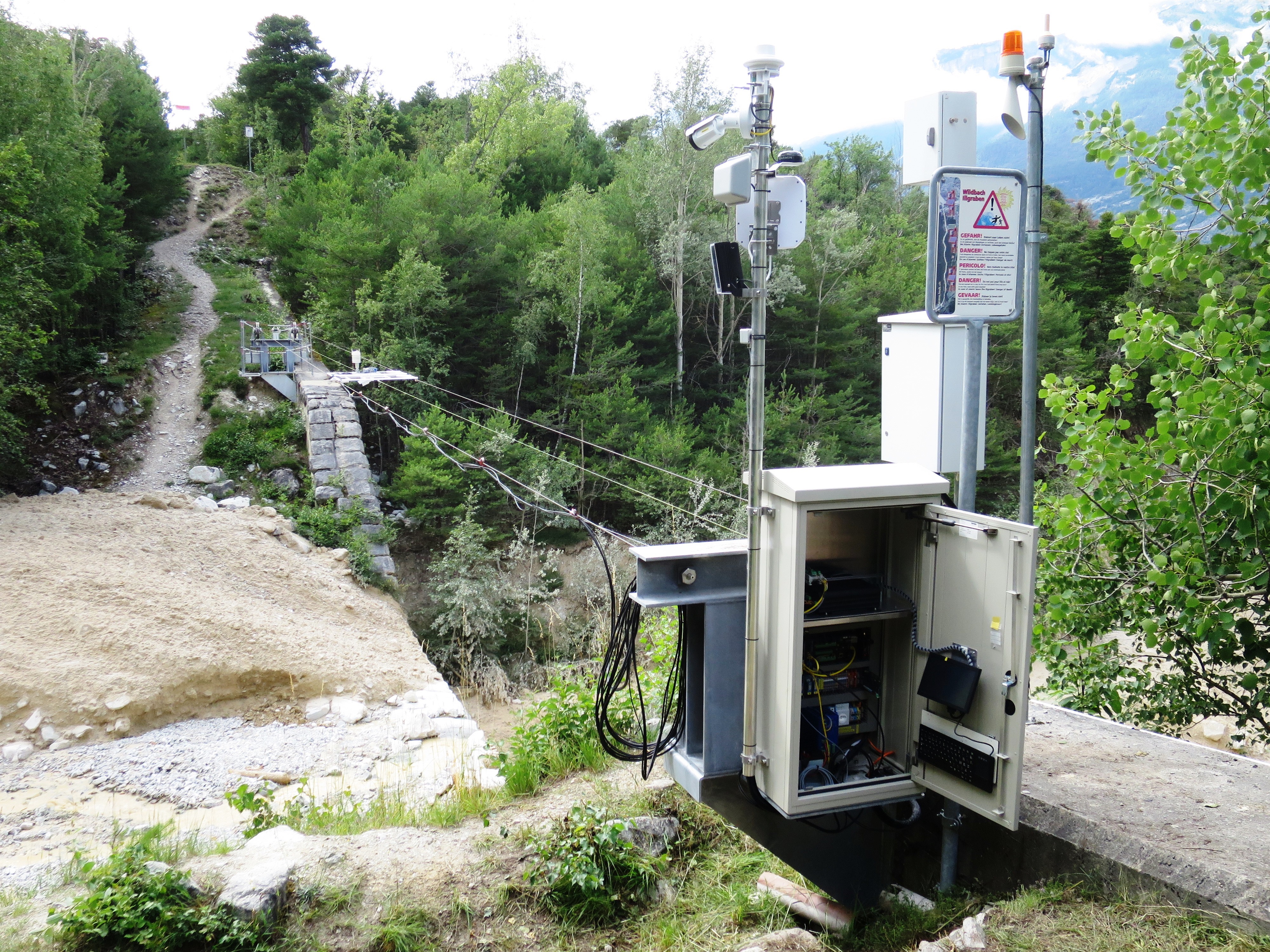
Researchers are studying debris flows in the Illgraben in detail: they are measuring the flow height, and the vibrations and forces exerted by debris flows. From this, the density of the debris flow mixture and the volume of an event are calculated. Various sensors and measuring devices are installed in and around the channel for this purpose. In various projects, the researchers have improved the understanding of debris flows.
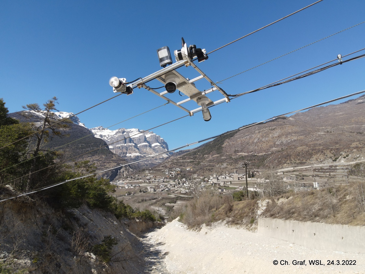
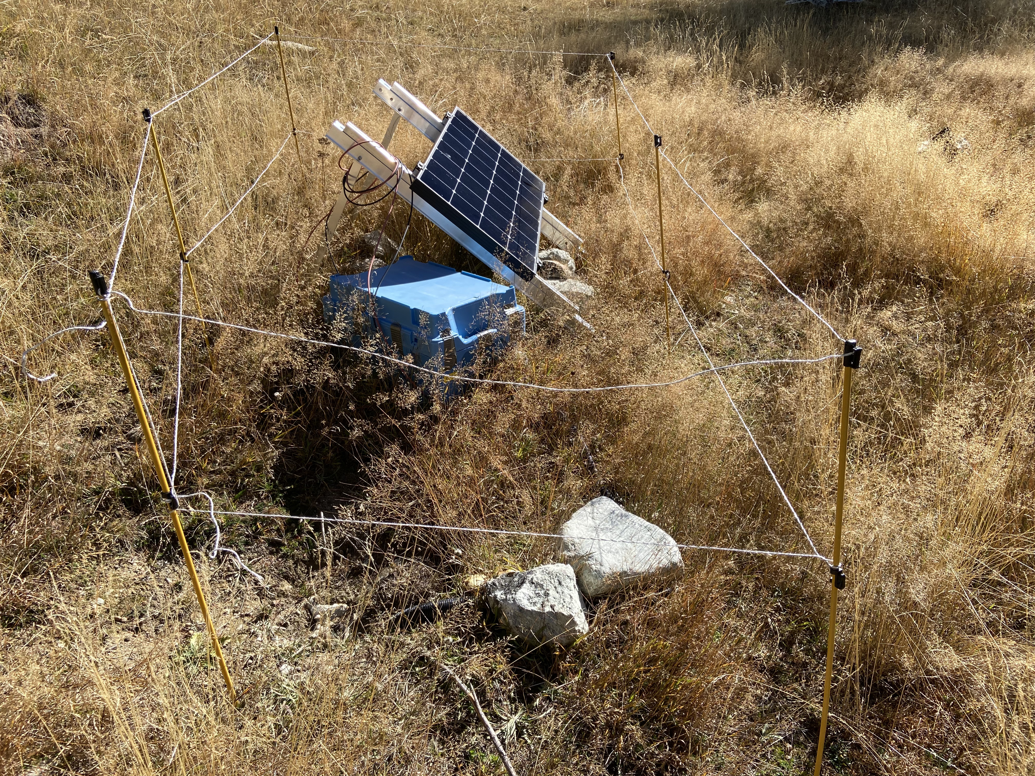
Radar sensors and video cameras are mounted on cables above the channel. Some of the cameras are connected to a floodlight for night-time recording. The radar sensors are used to measure the flow height in the channel. Geophones along the channel register vibrations, which are used to estimate flow velocities. Sensors buried near the initiation area measure soil moisture and help explain how debris flows start moving. A debris flow force plate measures the vertical and horizontal forces generated by debris flows.
As part of an innovative project, 3D LiDAR scanners are being used to make images of debris flows. Individual particles of wood or boulders are being tracked, and the local flow depth, flow-surface speed, and discharge are calculated. The researchers use this information to learn about movement within a debris flow.
Seismometers record the vibrations generated by debris flows. They also register mass movements in parts of the catchment that are difficult to reach and where it is not possible to install instruments. They detect debris flows extremely quickly. Using intelligent algorithms that analyse the seismic data in real time, WSL is testing new approaches for alarm systems.
Drone surveys are also being carried out in the Illgraben. Unlike other methods (such as terrestrial laser scanners), drones can cover large areas in a short amount of time. This remote sensing data is used to record changes, such as erosion by landslides or deposition, on the slopes of the catchment.
Assessing dangers 
Data generated at Illgraben is also being used by external partners. For example, researchers at Durham University have developed a debris flow erosion model. This is now integrated into the RAMMS:Debrisflow software package. RAMMS simulates the flow of debris flows and is used worldwide to assess hazards and provide a basis for planning protection measures.
Data availability
The main results of the measurements at Illgraben are available on the WSL’s research data portal EnviDAT, and will be updated periodically as methods to interpret the data improve. Publications describing the data, methods, and results are available on DORA and linked below.
Frequent debris flows 
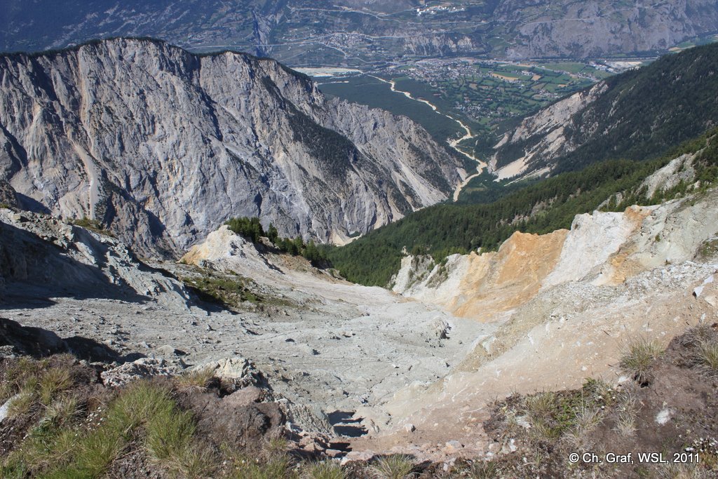
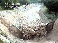
While debris flows are rather rare elsewhere, Illgraben has an average of three to five per year. This makes the Illgraben a particularly useful research site. The geological formations and structures in the initiation area, which is characterised by steep slopes and abundant sediment, favour debris flow formation. François Dufour explains how in this short video.
Related topics 
Contact 
Contact for seismic measurements 
Contact for LiDAR measures 
Contact for drone flights 
WSL publications 
Scientific publications 
Projects 
External projects 
Framework for Process Cascade Modelling of Rapid Mass Movements
The CCAMM II project at SLF investigates the influence of climate change on alpine mass movements and the associated new challenges. As part of work package 4.3, the researchers are using the Illgraben for testing. They want to find out how to include soil moisture in the prediction of mass movement runoff.
In this project, surface exposure dating of sediments at the Illgraben and in the Rhone River will be used to constrain long-term sediment discharge from the Illgraben. The Illgraben will also serve as a comparative catchment for the other study sites in this interdisciplinary project. WSL Contact: Brian McArdell
The aim of this project at Utrecht University is to decipher the mechanisms of bed erosion through experiments and field measurements. This will allow a more accurate estimation of the volume of debris flows, which will allow a better prediction of the hazards and a better mitigation. The project is also described by a video. WSL Contact: Brian McArdell
Projektname
In this project, which also involves USGS hydrologist Dr. Ben Mirus, we will investigate how debris flows and landslides are triggered in the upper watershed. We are also interested in how water in the channel bed entrains sediments in debris flows - a process that can significantly increase the hazard posed by debris flows.