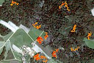
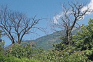
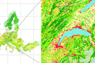
ORCID               https://orcid.org/0000-0001-6365-2151

Research Interests

  • Digital photogrammetry
  • Remote Sensing and its application to ecology
  • Forest Inventory techniques
  • Image matching & 3D data analysis
  • Application of LiDAR (Airborne and terrestrial LiDAR)

Projects

In the project Forest3DTwin, we want to build a prototype for the open storage of measured 3D forest plot data with reference data and are convinced that this can be established at WSL in the long term.

The aim of the project is to generate annual vegetation height models for Switzerland based on satellite imagery from Sentinel-2. Within the framework of the Swiss NFI, a workflow will be implemented and the accuracy of the resulting products will be estimated.

In this project, countrywide LiDAR data is used to derive the structural composition of forest edges for the entire Central Plateau. This forest edge characterization provides a basis for assessing the ecological quality of forest edges.

Information on the distribution of shrub forest is of broad interest. The aim of this project is a robust workflow to produce an up-to-date, nationwide and high-resolution distribution map of the two dominant shrub forest species in the Alpine region based on remote sensing.

Mit den hier entwickelten, schweizweiten Karten des baumartenspezifischen Verjüngungspotentials soll eine wichtige Grundlage für die Planung von Massnahmen zur Einleitung und Förderung von Naturverjüngung geschaffen werden.

Vorstudie zur praxisrelevanten Herleitung von flächendeckenden Verjünungspotentialkarten verschiedener Zielbaumarten im Schweizer Wald.

Entwicklung eines Prototyps für die Typisierung und Charakterisierung von Landschaften auf Basis von physischen und wahrgenommenen Merkmalen. Der Prototyp wird in den Kantonen Zug, Waadt und Graubünden entwickelt mit dem Ziel, mittelfristig auf die ganze Schweiz anwendbar zu sein.

The demand for the Swiss Habitat Map is very high. In order to meet the needs of the various users and to maintain usability, it is important that the habitat map is continuously maintained and improved.

In diesem Projekt wird untersucht, ob es möglich ist, die Kartierung der aktuellen Verteilung der Lebensräume durch die Kartierung der historischen Situation für das Jahr 1946 zu ergänzen, d.h. eine Periode mit zunehmender Landnutzungsintensität und abnehmender Biodiversität.

Das vom BAFU finanzierte Projekt verfolgt die laufenden Entwicklungen im Bereich Copernicus Land Monitoring Services aktiv. Dies umfasst den wissenschaftlichen und technischen Support im Bereich Landbedeckung / Landnutzung auf schweizerischer und europäischer Ebene.

On the basis of Sentinel-1 SAR data and using various test areas in Europe, a system is being developed to detect forest disturbances. The changes in the forest caused by disturbances are to be detected in the SAR data by means of time series analyses at stand level.

FORWARDS aims to develop, test, and implement a European Observatory that will supply timely and detailed information on European forests' vulnerability to climate change impacts, and provide knowledge to guide climate smart forestry

The SMURF project aims to improve soil moisture monitoring, which is crucial for understanding climate and ecosystem dynamics in Swiss forests.

The goal of this project is to contribute to the evaluation of non-native tree species that could potentially mitigate mortality in our forests, through scalable drone-based phenotyping approaches and the assessment of mechanistic traits, such as phenological plasticity and drought stress-resistance

This project investigates different ways of visualizing the complex data collected at the Pfynwald research site.

The emergence of visible tree-stress symptoms caused by the emerald ash borer occurs only several years after its arrival and are hard to tell apart from those caused by soil drought. Here, we investigate the potential of reflectance spectroscopy as an early-warning screening tool.

We demonstrate optimization pathways of forest management to mitigate climate change.

The joint project between Switzerland, Laos, Malaysia and China aims to research and develop the key technologies for forest resources dynamic monitoring and forest volume estimation based on ALS and other related remote sensing technologies.

Die Forschungsstation Seehornwald Davos wurde in den 80er-Jahren von der WSL initiiert und ist damit eine der ältesten permanent betriebenen Wald-Vegetations-Forschungsstationen in der Schweiz.

In the FNEWs project, a national remote sensing-based monitoring system for forest damage is being set up for Germany. In the WSL's work package the potentials of Sentinel-1 C-band data are analysed, demonstrated and operational procedures are designed.

Can people in urban regions recover from stress in green spaces or is there too much noise? Researchers from WSL and Empa explore the audio-visual requirements green spaces have to meet to enable noise-exposed people to recover from stress.

In this project, we investigate causes for the impacts of the extreme summer drought 2018 on the vitality of beech trees in different regions of the Swiss Plateau and Jura.

Which are the main mechanisms conveying adaptation on the organ and whole tree level, how fast does acclimation occur and how long is an acclimation potential sustained?

This project aims at improving the early detection of bark beetle damage in forests in the canton of Grisons as well as the prioritisation of management against bark beetle infestation in protective forests in the long term.

Spatially explicit distribution of habitats in Switzerland

Information on large scale snow depths is still mainly based on interpolated point measurements. New developments in sensor – and software technology for digital photogrammetry in the last two decades offer new possibilities to derive high resolution, digital surface models (DSM) even over snow covered high-alpine regions.

Establishing an inventory of soil water availability to trees in Swiss forest soils. This is done by means of model-based analysis of the water balances at 16 long-term monitoring sites in Switzerland, representing various geographical locations, soil and vegetation types.

We aim at providing the link between the belowground water regime, related to the triggering of shallow landslides, and aboveground structural properties of forests as well as between ground truth and remote sensing data in view of up-scaling from the local to the regional and supra-regional scale.

Highways are important corridors for the spread of invasive species. In this project, an automated detection and mapping of invasive alien plant species based on artificial intelligence (Deep Learning) and computer vision was developed and applied on highways of the Swiss Central Plateau.

In Switzerland, there are two very different forest monitoring instruments: The National Forest Inventory NFI and the socio-cultural forest monitoring WaMos. The aim of the current project is to bridge physical and social aspects.

Das Projekt wird vom BAFU finanziert, um die laufenden Entwicklungen im Bereich Copernicus Land Monitoring Services aktiv zu verfolgen.

In this project, we use satellite time series to map grassland-use intensity (i.e. time and frequency of mowing/grazing) across Switzerland on an annual basis and investigate its potential for ecological applications and biodiversity research.

Publications

Gui Y., Li W., Xia X.G., Eben B., Ginzler C., Wang Z. (2025) Mapping countrywide historical tree cover using semantic segmentation. IEEE Trans. Geosci. Remote Sens. 63, 5607414 (14 pp.). doi:10.1109/TGRS.2025.3532248 Institutional Repository DORA

Huber N., Bürgi M., Ginzler C., Eben B., Baltensweiler A., Price B. (2025) Historical habitat mapping from black-and-white aerial photography: a proof of concept for post World War II Switzerland. Int. J. Appl. Earth Obs. Geoinf. 138, 104464 (13 pp.). doi:10.1016/j.jag.2025.104464 Institutional Repository DORA

Kükenbrink D., Marty M., Rehush N., Abegg M., Ginzler C. (2025) Evaluating the potential of handheld mobile laser scanning for an operational inclusion in a national forest inventory – A Swiss case study. Remote Sens. Environ. 321, 114685 (15 pp.). doi:10.1016/j.rse.2025.114685 Institutional Repository DORA

Bruggisser M., Wang Z., Ginzler C., Webster C., Waser L.T. (2024) Characterization of forest edge structure from airborne laser scanning data. Ecol. Indic. 159, 111624 (12 pp.). doi:10.1016/j.ecolind.2024.111624 Institutional Repository DORA

Ferretti M., Fischer C., Gessler A., Graham C., Meusburger K., Abegg M., … Shackleton R.T. (2024) Advancing forest inventorying and monitoring. Ann. For. Sci. 81(1), 6 (25 pp.). doi:10.1186/s13595-023-01220-9 Institutional Repository DORA

Oehmichen K., Ackermann J., Adler P., Backa J., Beckschäfer P., Deutscher J., … Wimmer A. (2024) Ergebnisse des Fernerkundungsbasierten Nationalen Erfassungssystems Waldschäden (FNEWs). (Project Brief Thünen-Institut für Waldökosysteme, Report No.: 2177). Thünen-Institut für Waldökosysteme. 2 p. doi:10.3220/PB1712056632000 Institutional Repository DORA

Piermattei L., Zemp M., Sommer C., Brun F., Braun M.H., Andreassen L.M., … Yang R. (2024) Observing glacier elevation changes from spaceborne optical and radar sensors - an inter-comparison experiment using ASTER and TanDEM-X data. Cryosphere. 18(7), 3195-3230. doi:10.5194/tc-18-3195-2024 Institutional Repository DORA

Rüetschi M., Ginzler C. (2024) Das jährliche Vegetationshöhenmodell aus dem LFI: S2VHM. Infoblatt Arbeitsgr. Waldplan. manag. 2024(2), 1-3. Institutional Repository DORA

Shipley J.R., Frei E.R., Bergamini A., Boch S., Schulz T., Ginzler C., … Rixen C. (2024) Agricultural practices and biodiversity: conservation policies for semi-natural grasslands in Europe. Curr. Biol. 34(16), R753-R761. doi:10.1016/j.cub.2024.06.062 Institutional Repository DORA

Weber D., Ginzler C. (2024) Europaweite Daten zur Bodenbedeckung und Bodennutzung. Geomat. Schweiz. 122(3-4), 52-54. Institutional Repository DORA

Weber D., Schwieder M., Ritter L., Koch T., Psomas A., Huber N., … Boch S. (2024) Grassland‐use intensity maps for Switzerland based on satellite time series: challenges and opportunities for ecological applications. Remote Sens. Ecol. Conserv. 10(3), 312-327. doi:10.1002/rse2.372 Institutional Repository DORA

Weber D., Schwieder M., Huber N., Ginzler C., Boch S. (2024) Kartierung der Grünlandnutzung aus dem all methodisches Vorgehen und ökologische Anwendung für die Schweiz. Cartographier les surfaces herbagères depuis l'espace: méthodologie et application écologique pour la Suisse. Nat. Paysag. Nat. Landsch. Inside. (1), 35-39. Institutional Repository DORA

Zellweger F., Sulmoni E., Malle J.T., Baltensweiler A., Jonas T., Zimmermann N.E., … Webster C. (2024) Microclimate mapping using novel radiative transfer modelling. Biogeosciences. 21(2), 605-623. doi:10.5194/bg-21-605-2024 Institutional Repository DORA

Ginzler C., Bergamini A. (2023) Veränderung in den Biotopen von nationaler Bedeutung mit Luftbildern frühzeitig erkennen. Hotspot. 47, 30-31. Institutional Repository DORA

Huber N., Ginzler C., Pazur R., Descombes P., Baltensweiler A., Ecker K., … Price B. (2023) Countrywide classification of permanent grassland habitats at high spatial resolution. Remote Sens. Ecol. Conserv. 9(1), 133-151. doi:10.1002/rse2.298 Institutional Repository DORA

Jiang Y., Rüetschi M., Garnot V.S.F., Marty M., Schindler K., Ginzler C., Wegner J.D. (2023) Accuracy and consistency of space-based vegetation height maps for forest dynamics in alpine terrain. Sci. Remote Sens. 8, 100099 (15 pp.). doi:10.1016/j.srs.2023.100099 Institutional Repository DORA

Kolecka N., Ginzler C., Garcia Martin M., Tobias S. (2023) Airborne LiDAR Enables Measurements of "Greenness" Observed from the Human Perspective. GI_Forum J. Geogr. Inf. Sci. 11(2), 32-46. doi:10.1553/giscience2023_02_s32 Institutional Repository DORA

Kolecka N., Ginzler C., Garcia Martin M., Tobias S. (2023) Messung der Vegetation aus der Perspektive des Menschen. In Eidg. Forschungsanstalt für Wald, Schnee und Landschaft, WSL (Ed.), WSL Berichte: Vol. 134. Neue Fernerkundungs­technologien für die Umweltforschung und Praxis. Birmensdorf: Eidg. Forschungsanstalt für Wald, Schnee und Landschaft, WSL. 87-94. doi:10.55419/wsl:33081 Institutional Repository DORA

Leiterer R., Milani G., Wegner J.D., Ginzler C. (2023) ExoSilva - ein Multi­-Sensor­-Ansatz für ein räumlich und zeitlich hochaufgelöstes Monitoring des Waldzustandes. In Eidg. Forschungsanstalt für Wald, Schnee und Landschaft, WSL (Ed.), WSL Berichte: Vol. 134. Neue Fernerkundungs­technologien für die Umweltforschung und Praxis. Birmensdorf: Eidg. Forschungsanstalt für Wald, Schnee und Landschaft, WSL. 17-22. doi:10.55419/wsl:33057 Institutional Repository DORA

Mandl L., Stritih A., Seidl R., Ginzler C., Senf C. (2023) Spaceborne LiDAR for characterizing forest structure across scales in the European Alps. Remote Sens. Ecol. Conserv. 9(5), 599-614. doi:10.1002/rse2.330 Institutional Repository DORA

Show all
×