30.06.2022 | Isabel Plana | News SLF
Sliding, creeping, tilting, settling: unstable mountainsides undergo a range of complex movement and deformation processes. However, there is often no accurate information about these processes. Using the example of three large-scale slope instabilities in the Swiss Alps, researchers from the WSL Institute for Snow and Avalanche Research (SLF) have tested a promising new analysis method that provides a more detailed picture of the prevailing processes and could definitively improve hazard monitoring.
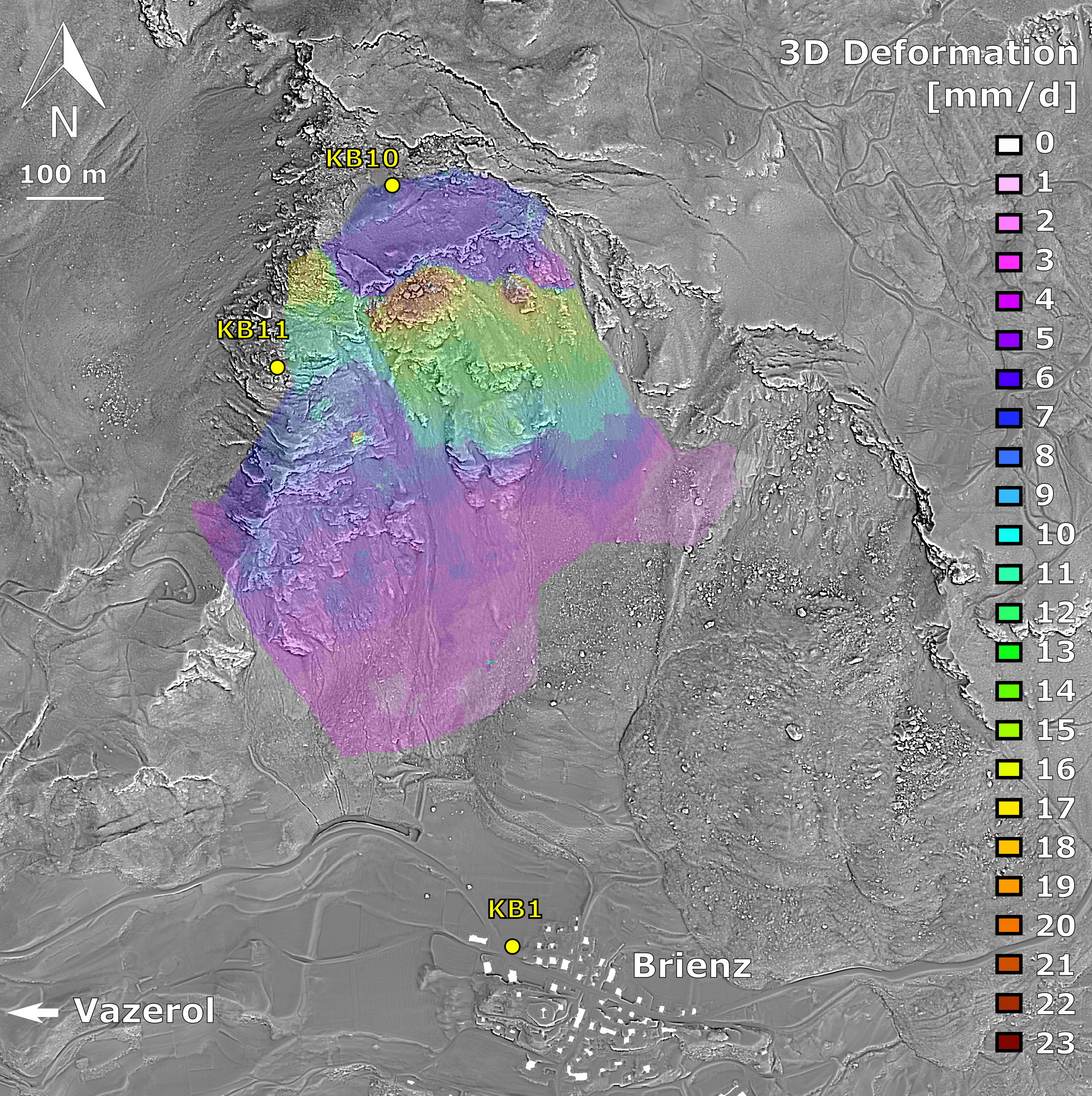
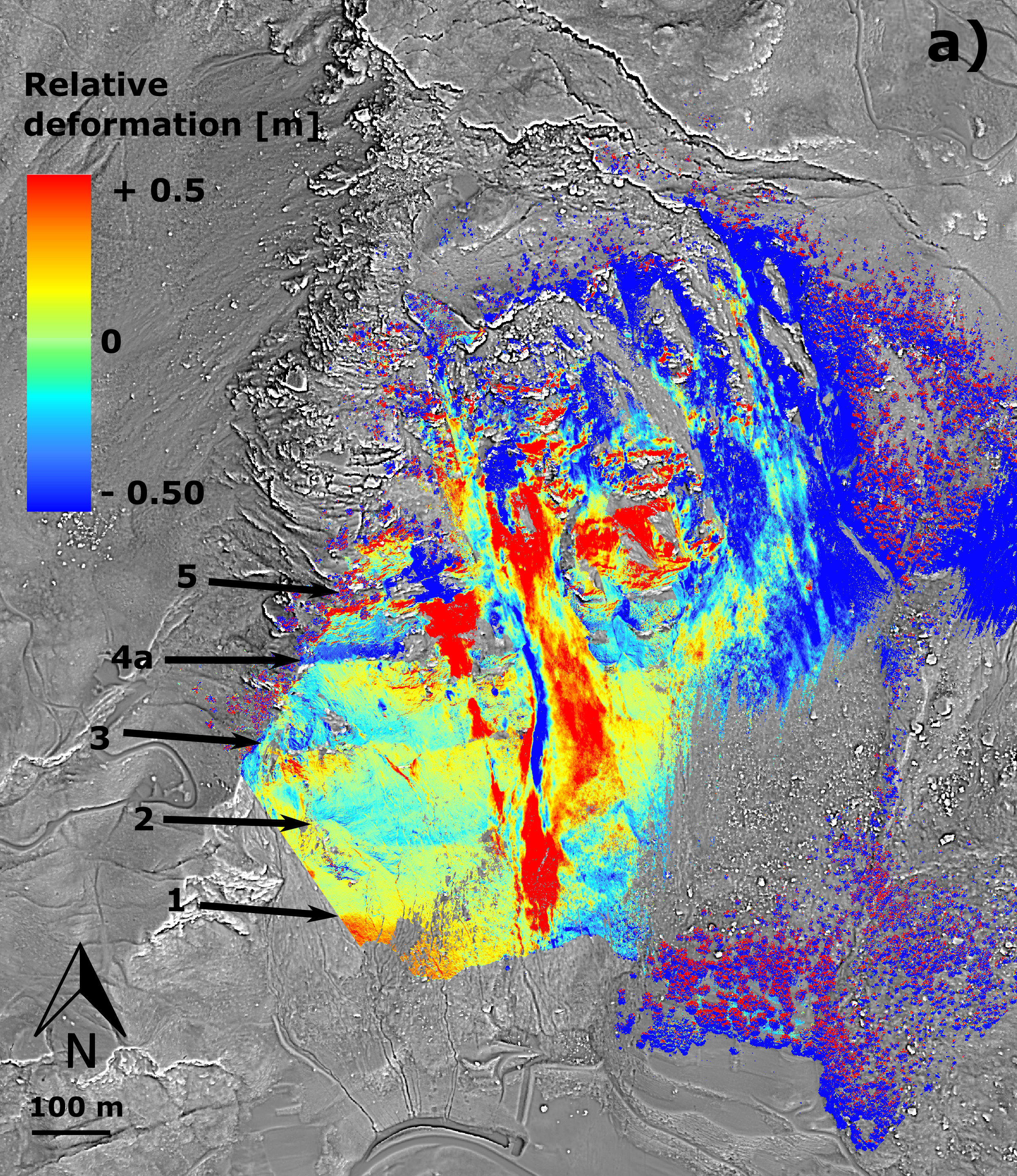
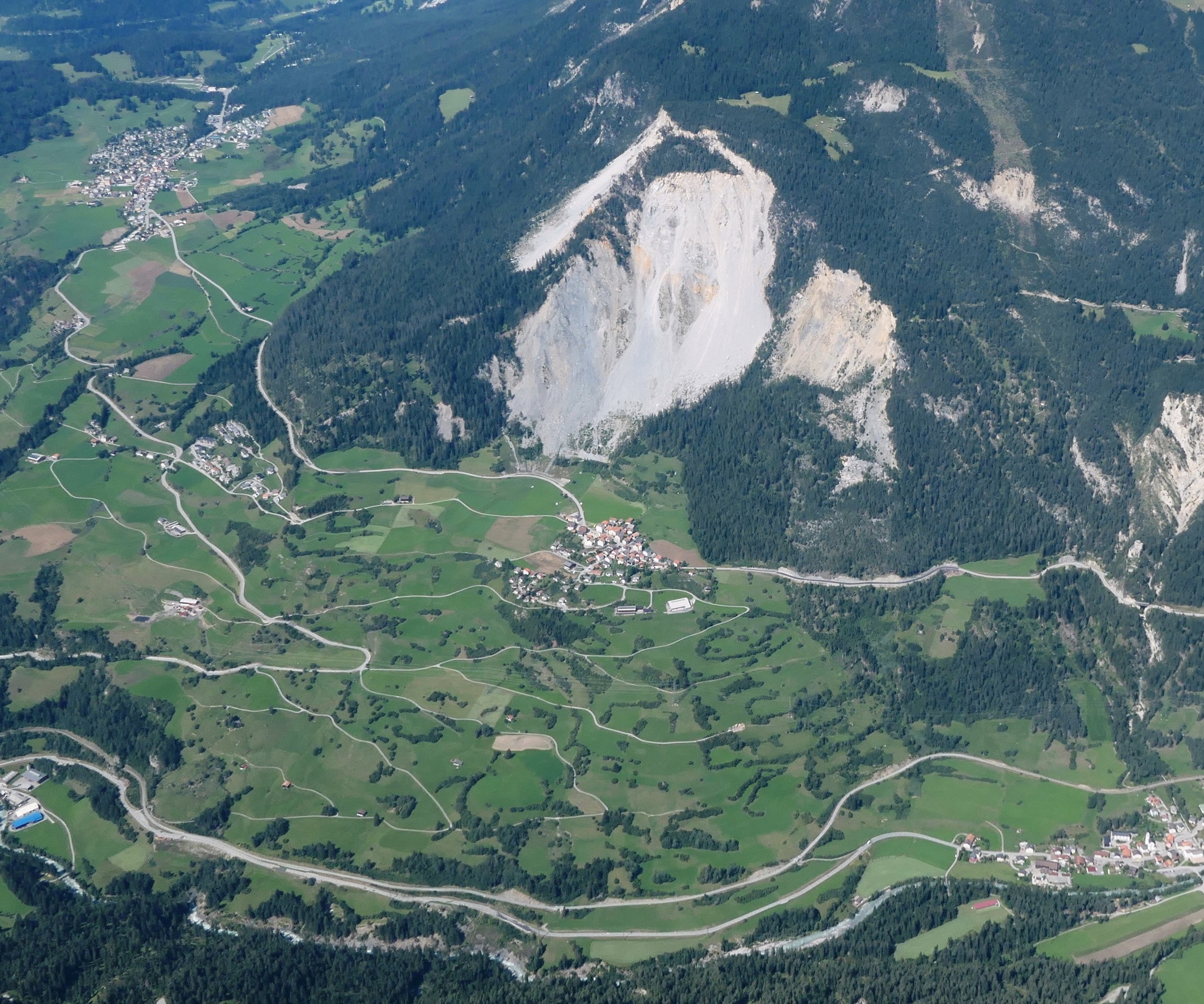
Pizzo Cengalo in the Bregaglia Range, Spitze Stei in the Bernese Oberland and Brienzer Rutsch, the slope above the village of Brienz/Brinzauls in Grisons, all have one thing in common: they have been moving for years and pose a danger to people and infrastructure, which is why they are monitored around the clock. These slopes are also regularly surveyed with a laser scanner using LiDAR technology, which scans the earth's surface based on a regular raster. For each recorded point in the terrain, the travel time of the laser beam is converted into a distance. A model of the terrain surface can then be calculated from the total of these measurement points, known as the point cloud. Comparing point clouds measured at different times highlights changes in the terrain. Of course, this comparison is done by computer and is far from simple. There are various ways to compare point clouds and calculate the differences between them. The approach chosen depends on the research question at hand.
The problem lies in the fact that none of the current methods provide a holistic, 3D image of the movement and deformation processes affecting a slope. They do show that the surface has changed and at what speed, but not how this happens. "Up to now, there has often been a lot of uncertainty involved in saying how exactly rock masses deform, i.e. sliding, settling, tearing apart or tilting, and how these processes interact in the different areas of a slope," says Robert Kenner, a member of the SLF's Alpine Environment and Natural Hazards research unit. However, this information would be very valuable for hazard management, which is why an algorithm for analysing point clouds recently developed at the ETH Zurich Institute of Geodesy and Photogrammetry piqued his interest.
Slope movements in 3D 
The new method allows a 3D deformation vector to be assigned to almost every point, meaning that it is possible to see exactly how individual points have shifted and figure out which deformation and movement processes are under way in different areas of a slope. "The other interesting thing about these 3D deformation vectors is that in some cases we can use them to model sliding surfaces." In other words, those layers hidden in the subsoil on which the earth and rock masses start to slide. Robert and his project team tested the algorithm supplemented by the sliding surface model using the examples of Pizzo Cengalo, Spitze Stei and Brienzer Rutsch and produced some unexpected results.
Tilting and sliding surfaces discovered 
In Brienz/Brinzauls, which was the site of a major landslide in 1878, it was long assumed that the slope was experiencing a continuous sliding process. "In the upper and lower part of the instability, our analysis confirmed the sliding. In between, however, we could not detect a sliding surface. Instead, our data here point to a tilting process." Drilling carried out by the cantonal authorities in the field shortly afterwards confirmed the SLF researchers' finding that there is no continuous sliding surface.
The analysis also provided new insights into the situation at Spitze Stei, which lies above Lake Oeschinen, a popular tourist destination. Here, the SLF researchers also uncovered a complex interplay of various deformation and movement processes. "Our work has shown that this instability involves two different sliding surfaces simultaneously." The researchers used the movement data to partially re-model the shape and position of these surfaces and produce a more accurate estimate of the volume of the unstable rock mass.
As for Pizzo Cengalo, the new analysis method has largely confirmed the existing geological model: a tilting process is under way. The shear zones in the slope were accurately detected.
Test passed 
The results of their study were so convincing that Robert and his colleagues are already in the process of integrating the new method into the ongoing hazard monitoring programme. "The 3D analysis of the point cloud provides a considerable amount of information helping us to understand movement and deformation processes in rock slopes, and this in turn will definitively improve hazard assessment," says Robert. The researchers will also run tests at other sites in the near future in order to validate the method and, in particular, the sliding surface model under other conditions too.
Contact 
Original publication 
Copyright 
WSL and SLF provide the artwork for imaging of press articles relating to this media release for free. Transferring and saving the images in image databases and saving of images by third parties is not allowed.