03.08.2022 | Perry Bartelt | News SLF
The SLF has developed large-scale natural hazard maps for Georgia using a combination of terrain analyses and numerical modelling tools.
The United Nations Development Programme (UNDP) commissioned the SLF's Alpine Environment and Natural Hazards research unit to forecast debris-flow and avalanche hazards for Georgia. The aim of the six-month project, part-funded by the Swiss Agency for Development and Cooperation (SDC), was to identify regions in the South Caucasus at high risk from debris flows and avalanches.
Over 2 million avalanches simulated with RAMMS 
The underlying technology for the project was developed by the SLF and combines two software tools. The first step involves using terrain analysis algorithms to automatically identify and delimit avalanche starting zones in mountainous areas. The identified starting zones are then put through the RAMMS modelling tool to predict the avalanche runout zones. The calculation methodology used for Georgia was recently published in the journal Natural Hazards and Earth System Sciences and involves simulating different avalanche return periods based on a range of release depths in the snowpack. Given that avalanche-prone areas are characterised by the avalanche impact pressure, high-resolution digital terrain models are a key component of the modelling chain. In this way, endangered buildings and road sections can be identified. In total, the SLF researchers simulated over 2 million avalanches for Georgia, for various snow and forest cover scenarios, and used them to create hazard indication maps. As a follow-up step, the engineers on site are now carrying out more detailed simulations, but only in areas where the avalanche hazard is extreme.
Training local experts 
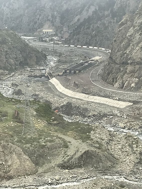
The project concluded in April 2022 with a one-week RAMMS workshop for research scientists at Georgia's National Environment Agency in Tbilisi. Participants learned how to work with the modelling tool and also spent a day in the field, visiting Devdoraki, where in 2014 a large debris flow destroyed a hydropower plant under construction near the Russian border. Getting there involves travelling on roads that are vulnerable to avalanches. Thanks to the SLF's hazard indication mapping, it should now be possible to better assess the risk of debris flows and avalanches.
Contact 
Links 
Copyright 
WSL and SLF provide the artwork for imaging of press articles relating to this media release for free. Transferring and saving the images in image databases and saving of images by third parties is not allowed.


