
25.05.2021 | Claudia Hoffmann | News SLF
The complex structure of forests makes it difficult to calculate snowmelt in forested areas. However, with the help of various drone, aircraft and ground-based measuring systems, as well as advances in computer simulations, this can now be done more effectively than before, enabling more precise predictions of snowmelt, but also more accurate climate forecasts.
Meltwater from snow makes an important contribution to water supply, and melting snow also triggers ecological processes that are key to plant growth. It is therefore important to be able to predict how much meltwater will be available. However, such calculations are much more difficult to make for forests than for open areas. This is because the patterns of snow distribution and snowmelt in the forest are complicated, with forest density, gaps and edges as well as shadows making a big difference to the melt rates. Most snowmelt models cannot represent the spatial differences in the forest structure and their impact on mass and energy flows. This leads to errors in the calculation of snowmelt, but also to uncertainties in the modelling of the future climate, since the reflection and absorption capacity of snow-covered forests is a factor in this.
Now, researchers in the Snow Hydrology Research Group at the WSL Institute for Snow and Avalanche Research (SLF) have succeeded in significantly improving snowmelt forecasts in forested areas. Measurements and computer modelling both have a key role to play:

- Ground, drone and aircraft-based observations: Solar and thermal radiation are important factors for snowmelt in forests. Radiation sensors, cameras and laser scanners allow solar and thermal radiation patterns of the forest, the forest structure and varied snow cover patterns to be accurately measured.
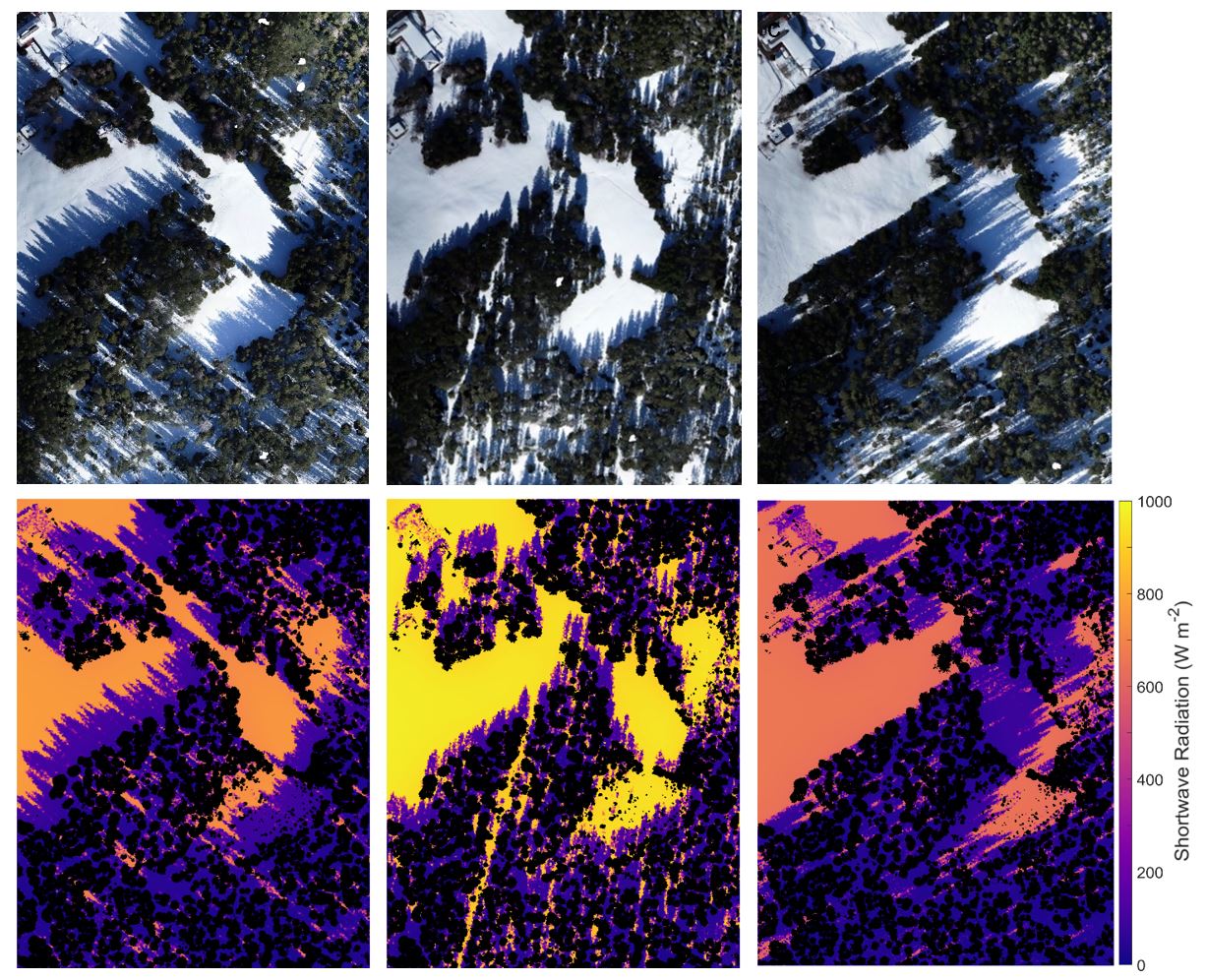
- Modelling radiation and snow in forests: Using the aforementioned measurement data, the researchers were able to improve existing computer models for snowmelt. Hemispherical images looking up into the tree crowns from the forest floor are a particularly important tool. These photos show where and to what extent solar radiation is blocked by the forest. By combining this information with the path of the sun, it is possible to calculate how much radiation hits the ground at independent point locations within the forest throughout the snow season. This allows the forest structure to be represented very accurately in the radiation models.
By integrating the enhanced radiation models into a physics-based forest snow model, the researchers can now make much more precise snowmelt predictions. On the one hand, this will help to improve the forecasts of the operational snow-hydrological service (OSHD), which are relevant for flood warnings, for example. In addition, it will be possible to better understand the feedback between snow, reflected radiation and the climate and so improve climate predictions in snow-covered forest regions.
Contact 
Links 
Publications 
Copyright 
WSL and SLF provide the artwork for imaging of press articles relating to this media release for free. Transferring and saving the images in image databases and saving of images by third parties is not allowed.