
27.05.2024 | Gottardo Pestalozzi | WSL News
A novel predictive tool developed at the Swiss Federal Research Institute WSL shows where plant species occur in Switzerland today and in the future. Among other things, it uses millions of observations reported by volunteering citizens. The combination of this huge amount of data with adaptive algorithms leads to an unprecedented accuracy of distribution maps.
Extracting the crucial information for research and practice from an enormous amount of data is one of the major challenges in the age of big data. WSL researchers have now developed a tool that can use reported plant observations to estimate the current and future distribution of plant species in Switzerland with a high degree of accuracy.
Knowing and predicting the distribution of plant species 
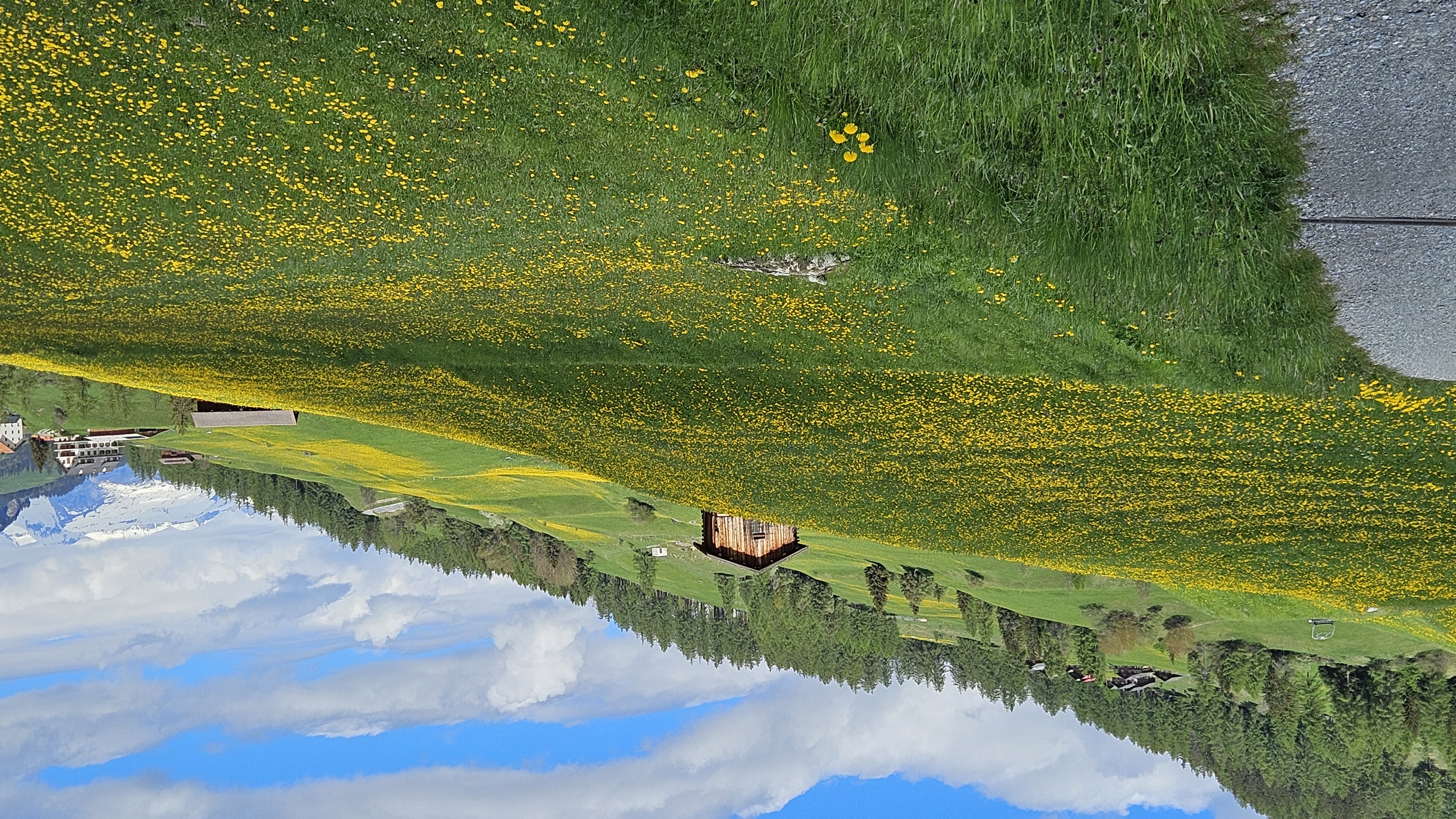
Researchers measure the state of biodiversity with observations in the field and extrapolations (modeling) on the computer. By recording the preferred habitat of a species, i.e. its ecological niche, as well as knowing local environmental conditions, they can create distribution maps with the help of algorithms.
Research is benefiting from the fact that "citizen science" or participatory science is in vogue. The opportunities to observe and identify plants with apps and share the data have increased significantly in recent years. Philipp Brun, lead author of the study, which has been published in Nature Communications says: "Through observations from the public, we researchers obtain many times more information than would be possible through our own field work". The many observations do not only provide insight into the preferred locations of the species, but also show which plants grow or flower in which season.
New tool opens up new perspectives 
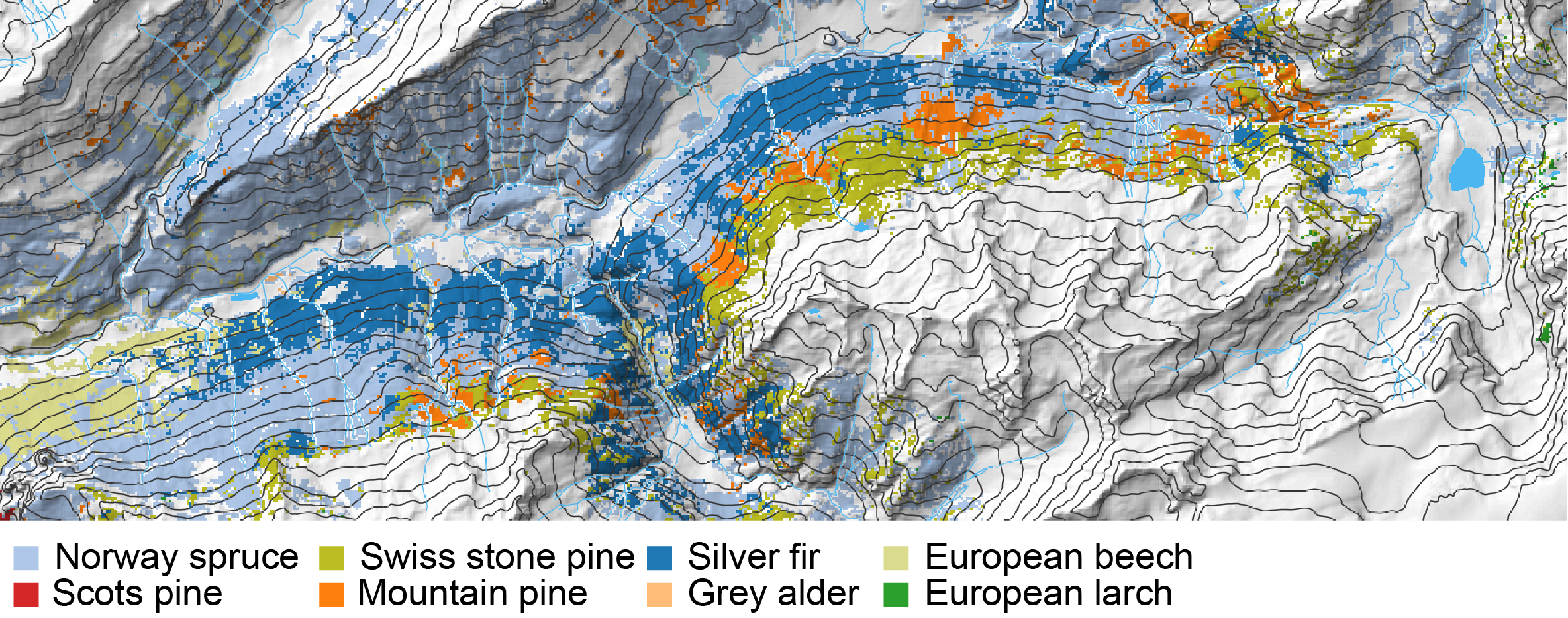
Based on 6.7 million plant observations and using artificial intelligence, WSL has developed a new type of biodiversity model that calculates the distribution of 2477 plant species in Switzerland. It shows which plants can be observed where and how they develop over the course of the season at a resolution of 25 meters, day by day. For certain species, moreover, it is possible to estimate when they are likely to flower.
The recently published study shows that this deep learning biodiversity model can predict the distribution of species and, in particular, the composition of species communities more accurately than previous approaches. For example, the WSL tool can show which tree species is most likely to dominate in which forest.
Changes expected in response to climate change are also included in the computations. The tool can be used to predict not only whether a species could disappear, remain or reappear at a location, but also how its occurrence could change within the season.
The quantity of observations is decisive 
The model is most accurate in regions with a high density of available observations. Philipp Brun is convinced of the potential of this still new and expandable tool: "It is quite possible that this seasonal biodiversity model with the deep learning approach will soon become a standard tool in ecological research."
The biodiversity crisis is currently one of the greatest challenges society is facing. Plants are largely responsible for the structure of ecosystems and fulfill crucial ecosystem functions. It is therefore of great importance to understand in detail the distribution patterns of plant species and their possible response to environmental changes. Only in this way can we take effective and sustainable measures to protect biodiversity.
Example FlorID 
Users of InfoFlora's popular FlorApp can share their observations for scientific purposes. The FlorID module was developed in close collaboration with InfoFlora, the National Data and Information Center of the Swiss Flora, and can also be accessed in a user-friendly version via a website (florid.ch) or as a module in the FlorApp can be used.
The predictions of the model described here are also used by FlorID. The predictions from this biodiversity model make the identification of plants even more accurate than would be possible purely based on image recognition. FlorID serves not only to support citizen scientists in the field, but also to control the quality of the InfoFlora database.
Always up to date: Subscribe to the WSL Newsletter
Contact 
Publication 
Copyright 
WSL and SLF provide image and sound material free of charge for use in the context of press contributions in connection with this media release. The transfer of this material to image, sound and/or video databases and the sale of the material by third parties are not permitted.