
21.12.2022 | Sara Niedermann | News SLF
Solar and wind energy are seen as one of the keys to generating more green electricity in Switzerland in the future. In the La Stadera area above the Lukmanier Pass (commune of Medel, canton of Grisons), armasuisse Real Estate, the real estate competence centre of the Federal Department of Defence, Civil Protection and Sport (DDPS), wants to test one of Switzerland's first combined wind and solar facilities in the Alpine region. When planning such systems, it is important to consider the snow and avalanche situation.
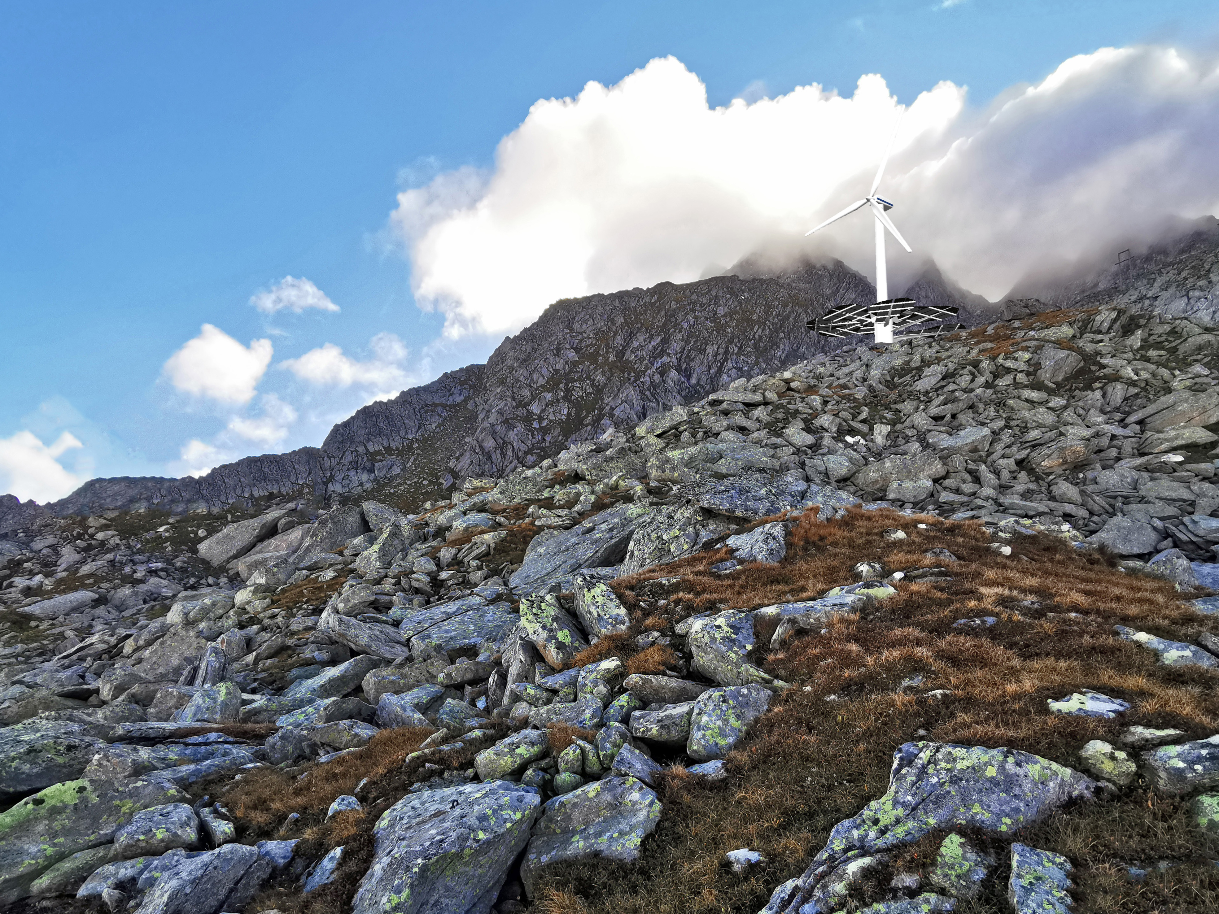
armasuisse Real Estate is planning to build one of the first small-scale wind-solar farms above the Lukmanier Pass, next to the former midway station of the military transport cableway. The aim of the test system is to ascertain whether the hybrid facility in the alpine terrain around La Stadera is suitable for generating sustainable energy. The Swiss system supplier installed a prototype in autumn 2022. The actual hybrid test system, comprising a small wind turbine with bifacial solar cells, is set to enter trial operation in autumn 2023.
Stefan Margreth is head of the SLF's Avalanche Protection Measures group. He and his team devise solutions to all kinds of complex issues related to avalanches and snow. On behalf of armasuisse Real Estate, Margreth's team analysed the snow and avalanche situation in the La Stadera area. "This is an important step," he explains. "When planning, you should always think about how sustainable the project is. For instance, it makes little sense to install a system in a steep avalanche area that is prone to extreme forces."
Field surveys and avalanche software calculations 
When compiling an expert report, the SLF experts first look at the snow and wind situation as well as the topography in the study area. How much snow does the area receive? How is the snow distributed? Which direction does the wind come from? Does snow get blown off the ridge and are there depressions in the area that get filled in? "As well as topography and snow distribution, other key planning criteria include accessibility and proximity to existing lines for transporting energy away from the site," says Margreth.
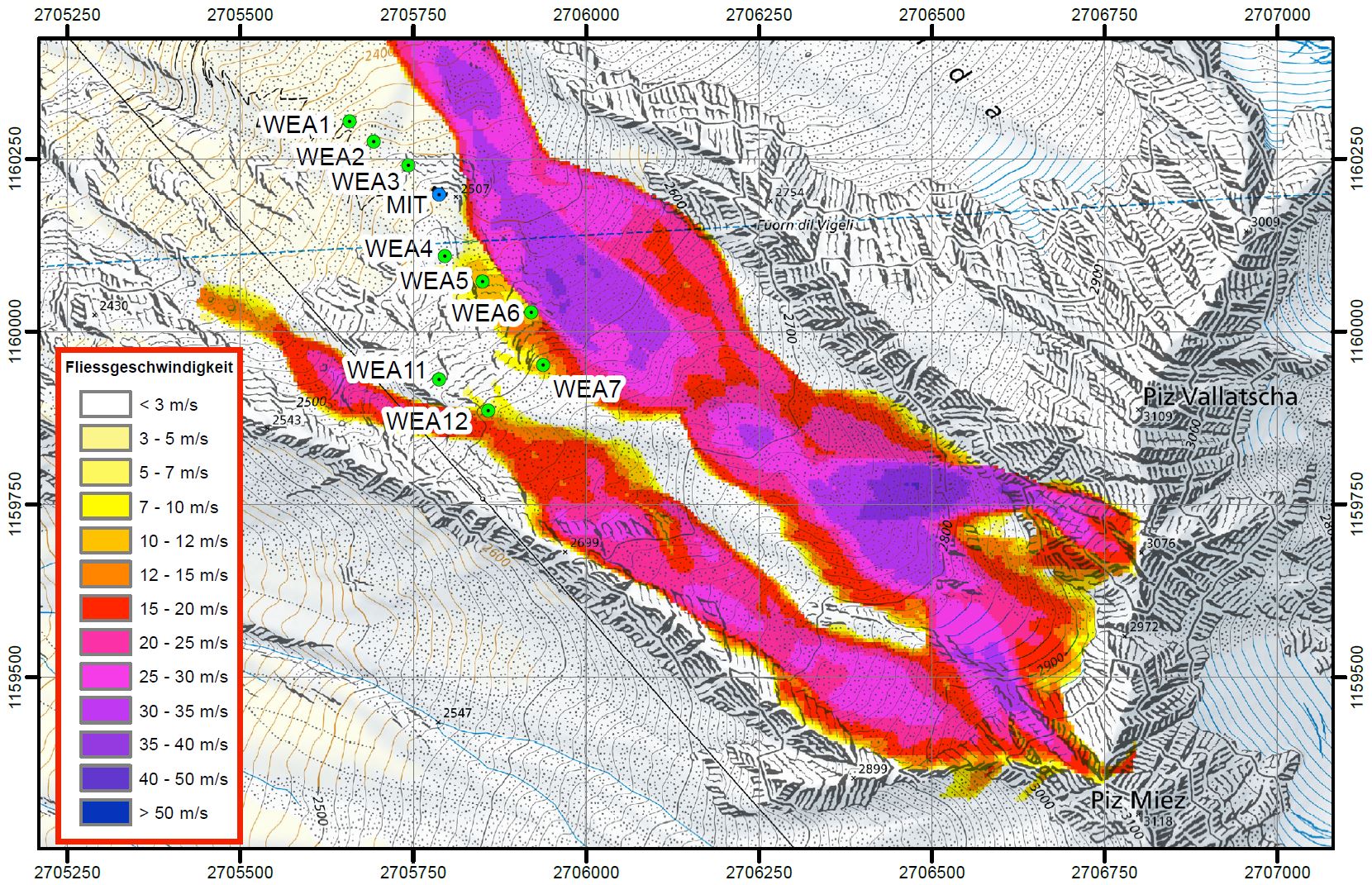
As part of their field survey, Margreth and his team analyse where avalanches could potentially occur. Historical photos taken in winter or records of earlier avalanches are helpful for this assessment (where available). The SLF experts' next step is to calculate the flow height and velocity of dense flow and powder avalanches for different scenarios, using the RAMMS avalanche simulation program. Then they interpret the data. "We want to know how the avalanche pressures are distributed over an area. We then use intensity maps to develop the hazard maps," explains Margreth. The hazard maps featuring yellow, blue, red and white areas serve as a basis for identifying danger zones in land use planning and in the formulation of building requirements as part of the planning permission process.
The SLF's calculations showed that most of the planned wind-solar facilities were suitably positioned. However, a few were in at-risk areas. Thanks to the expert report, armasuisse Real Estate was able to optimise the location of these facilities.
Contact 
Copyright 
WSL and SLF provide the artwork for imaging of press articles relating to this media release for free. Transferring and saving the images in image databases and saving of images by third parties is not allowed.