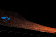
Dynamic debris-flow runout models are applied by practitioners (1) to generate hazard maps, (2) to help design mitigation measures such as dams and warning systems, (3) to explore potential impacts of rare events such as pro-glacial lake failure, and (4) to illustrate the hazard process to local decision makers and stakeholders. Automated observations of debris flows in several torrents have shown a large degree of variability in the flow process, ranging from fast muddy debris floods to relatively slow debris flows with granular fronts, at any given torrent. It is not yet possible to predict with certainty which type of debris flow can be expected in any given catchment. The prediction problem is amplified by the fact that topographic data are generally coarse (2m horizontal resolution in Switzerland) compared with typical channel widths (1–10 m) and because channel topography changes with time. These challenges and their impact on hazard assessment is illustrated using recent examples of typical applied projects. Herein we use the RAMMS debris-flow runout model. However, the general procedures presented here are applicable to other similar runout models. Common points in these examples include the accurate assessment of potential erosion, deposition, and avulsion along the channel, as well as the systematic modification of the friction coefficients in the model to account for variations in water content, sediment size, channel-bed roughness, and other properties of the flow. We mention the main challenges in these steps, as the exact procedure is still not clearly regulated in Switzerland. In general, it is desirable to work with several scenarios to account for multiple flow surges and the erosion and deposition produced by each surge, and uncertainties in the expected debris-flow type (granular vs. muddy). Thus, for the generation of appropriate scenarios, experience in the field and with the use of runout models is essential.
See Institutional Repository DORA
