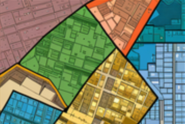
Abolhasani, S., Taleai, M. and Lakes, T. 2022. Developing a game-theoretic interactive decision-making framework for urban land-use planning. Habitat International, 141, 102930. https://doi.org/10.1016/j.habitatint.2023.102930
Abolhasani, S., Taleai, M. and Lakes, T. 2022. A collective decision-making framework for simulating urban land-use planning: An application of game theory with event-driven actors. Computers, Environment and Urban Systems, 94, 101795. https://doi.org/10.1016/j.compenvurbsys.2022.101795
Sadooghi, S. E., Taleai, M. and Abolhasani, S. 2022. Simulation of urban growth scenarios using integration of multi-criteria analysis and game theory. Land Use Policy, 120, 106267. doi.org/10.1016/j.landusepol.2022.106267
Abolhasani, S. and Taleai, M. 2020. Assessing the effect of temporal dynamics on urban growth simulation: Towards an asynchronous cellular automata. Transactions in GIS, 24(2), 332-354. https://doi.org/10.1111/tgis.12601
Abolhassani, A., Taleai, M., Karimi, M. and Rezaee Node, A. 2016. Simulating urban growth under planning policies through parcel-based cellular automata (ParCA) model. International Journal of Geographical Information Science, 30(11), 2276-2301. https://doi.org/10.1080/13658816.2016.1184271
Sadooghi, E., Taleai, M., Abolhasani, S. 2020. Integration of cellular automata model and game theory to evaluate urban development scenarios. Journal of Geomatics Science and Technology, 10(1): 65-82.
Ghazi Mirsaeed, S.M., Taleai, M., Mohammadi, M., Abolhasani, S. 2019. Scenario making for land subdivision in the urban development process; case study: marginal area of semnan". Human Geography Research, 51(3), pp. 625-652. doi: 10.22059/jhgr.2018.238968.1007514.
Abolhasani, S., Karimi, M., Taleai, M. 2015. Modeling index of land-use suitability based on vector-based cellular automata by focusing on neighborhood effect and its application to simulate land use changes. Journal of Geomatics Science and Technology, 5 (1), 25−42.
Abolhasani, s., Taleai, M., Karimi, M. 2015. Modeling urban growth through vector-based cellular automata at parcel level." The Journal of Spatial Planning, 19 (3), 199−232.
Abolhasani, S., Karimi, M., Taleai, M. 2014. Assessing the neighbourhood effects and suitability at the fine resolution. First National Conference of Geography, Urban planning and sustainable development. Tehran, Iran.


